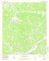
1963 Map of Adams SE
USGS Topo · Published 1982About this map
Henderson Ranch and Rocking R Ranch anchor this landscape in Schleicher County, where the settlement pattern is defined by large family-held tracts and critical water sources. The terrain is dominated by the bifurcated drainage of North Valley and its North Valley Prong, alongside the broad expanse of Middle Valley. In this arid portion of the Edwards Plateau, named water sources like Eighteenmile Waterhole and Panther Bluff Waterhole were essential for the cattle operations that shaped the local economy. The 1963 survey also documents modern infrastructure cutting across the traditional ranch lands, including multiple pipelines and numerous Gravel Pits, while red dashed lines denote the extensive fence lines separating holdings like James Ranch and Crosby Ranch.
Find a feature on this map
19 named features on this map. Tap any name to fly to it.
Don’t see what you’re looking for? This feature index may not catch every label — zoom into the map to look around manually.
Map Details
Editions of this 1963 Adams SE Map
3 editions found
Other maps of this area

1893 · Fort McKavett
USGS Topo · 1:125,000

1954 · Sonora
USGS Topo · 1:250,000

1958 · Sonora
USGS Topo · 1:250,000

1963 · Buffalo Well
USGS Topo · 1:24,000

1963 · Buffalo Well NW
USGS Topo · 1:24,000

1963 · Adams
USGS Topo · 1:24,000

1963 · Adams NW
USGS Topo · 1:24,000

1963 · Adams SE
USGS Topo · 1:24,000

1963 · Adams SW
USGS Topo · 1:24,000
1963 · Coal Kiln Draw
USGS Topo · 1:24,000