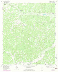
1963 Map of Adams SE
USGS Topo · Published 1983About this map
North Valley and Middle Valley dominate this West Texas landscape, where life centered on the vital presence of waterholes and large-scale ranching operations. The terrain is marked by a network of drainage systems like Bull Hollow and the North Valley's prong, which are punctuated by essential desert water sources including Eighteenmile Waterhole, Hurricane Bluff Waterhole, and Twelvemile Waterhole. The map illustrates the specialized infrastructure of the 1960s cattle economy, detailing several family-named properties such as the Henderson Ranch, Rocking R Ranch, and the Figure 3 Ranch. The presence of several Pits and Gravel Pits alongside modern pipelines suggests the early industrial intersections of ranching and resource extraction in Schleicher County during this period.
Find a feature on this map
18 named features on this map. Tap any name to fly to it.
Don’t see what you’re looking for? This feature index may not catch every label — zoom into the map to look around manually.
Map Details
Editions of this 1963 Adams SE Map
3 editions found
Other maps of this area

1893 · Fort McKavett
USGS Topo · 1:125,000

1954 · Sonora
USGS Topo · 1:250,000

1958 · Sonora
USGS Topo · 1:250,000

1963 · Buffalo Well
USGS Topo · 1:24,000

1963 · Buffalo Well NW
USGS Topo · 1:24,000

1963 · Adams
USGS Topo · 1:24,000

1963 · Adams NW
USGS Topo · 1:24,000

1963 · Adams SE
USGS Topo · 1:24,000

1963 · Adams SW
USGS Topo · 1:24,000
1963 · Coal Kiln Draw
USGS Topo · 1:24,000