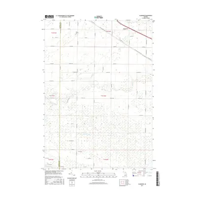
2017 Map of Alamando
USGS Topo · Published 2017About this map
The settlement of Alamando sits in the northeast corner of this Michigan survey, where the diagonal path of the Pere-Marquette State Trail cuts through the landscape. This corridor, following the historic rail line, passes just north of the Warren Township Cem, which serves as a significant landmark for genealogists tracing local families in this portion of Midland County. The terrain is defined by a dense network of water drainage systems, including the winding Salt River and its S Br Salt River, alongside the Chippewa River near the southern boundary. These waterways are complemented by numerous agricultural drainage features like Teed Drain and Carrol Cr Drain, reflecting a landscape heavily modified for farming. The grid of country roads, including N Alamando Rd and Coleman Rd, provides a structured view of the rural township divisions and residential patterns as they existed in the mid-2010s.
Find a feature on this map
50 named features on this map. Tap any name to fly to it.
Don’t see what you’re looking for? This feature index may not catch every label — zoom into the map to look around manually.
Map Details
Editions of this 2017 Alamando Map
This is the sole edition of this map. No revisions or reprints were ever made.
Other maps of this area

1930 · Shepherd
USGS Topo · 1:48,000

1934 · Sanford
USGS Topo · 1:62,500

1936 · Shepherd
USGS Topo · 1:62,500

1936 · Sanford
USGS Topo · 1:62,500

1954 · Midland
USGS Topo · 1:250,000

1958 · Midland
USGS Topo · 1:250,000

1959 · Midland
USGS Topo · 1:250,000

1966 · Midland
USGS Topo · 1:250,000

1969 · Coleman
USGS Topo · 1:24,000
1969 · Edenville
USGS Topo · 1:24,000