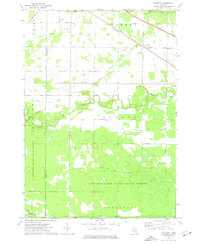
1973 Map of Alamando
USGS Topo · Published 1976About this map
The Salt River winds through the central landscape of this Midland and Isabella County border region, where the Chesapeake and Ohio railroad line cuts a diagonal path toward the settlement of Alamando. This area is characterized by the convergence of several major timber and water resources, with large portions of the terrain dedicated to the Tittabawassee River State Forest and the Chippewa River State Forest. Local infrastructure is anchored by the Township Cem and the Geneva Hope Ch, providing essential touchstones for genealogical research in this rural Michigan township setting.
Find a feature on this map
38 named features on this map. Tap any name to fly to it.
Don’t see what you’re looking for? This feature index may not catch every label — zoom into the map to look around manually.
Map Details
Editions of this 1973 Alamando Map
This is the sole edition of this map. No revisions or reprints were ever made.
Other maps of this area

1930 · Shepherd
USGS Topo · 1:48,000

1934 · Sanford
USGS Topo · 1:62,500

1936 · Shepherd
USGS Topo · 1:62,500

1936 · Sanford
USGS Topo · 1:62,500

1954 · Midland
USGS Topo · 1:250,000

1958 · Midland
USGS Topo · 1:250,000

1959 · Midland
USGS Topo · 1:250,000

1966 · Midland
USGS Topo · 1:250,000

1969 · Coleman
USGS Topo · 1:24,000
1969 · Edenville
USGS Topo · 1:24,000