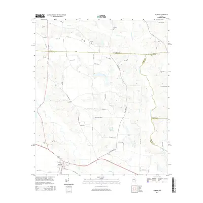
2014 Map of Alapaha
USGS Topo · Published 2014About this map
Alapaha serves as the primary hub in this Georgia landscape, situated at the junction where the Alapaha River begins its winding course southward. The surrounding rural territory in Berrien County is defined by a dense network of local roads named for families and landmarks, such as Sam Fuller Rd, Eddie Tucker Rd, and Deberry Store Rd. These routes connect dispersed settlements like Gladys and provide access to numerous small community burial grounds that dot the landscape.
Find a feature on this map
71 named features on this map. Tap any name to fly to it.
Don’t see what you’re looking for? This feature index may not catch every label — zoom into the map to look around manually.
Map Details
Editions of this 2014 Alapaha Map
This is the sole edition of this map. No revisions or reprints were ever made.
Other maps of this area

1953 · Waycross
USGS Topo · 1:250,000

1958 · Waycross
USGS Topo · 1:250,000

1972 · Tenmile Bay
USGS Topo · 1:24,000

1972 · Willacoochee
USGS Topo · 1:24,000

1972 · Lax
USGS Topo · 1:24,000

1972 · Ambrose
USGS Topo · 1:24,000

1972 · Ocilla East
USGS Topo · 1:24,000

1973 · Ocilla West
USGS Topo · 1:24,000

1973 · Sapps Lake
USGS Topo · 1:24,000

1973 · Enigma
USGS Topo · 1:24,000