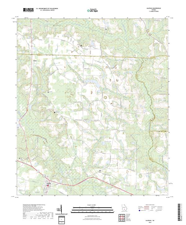
2024 Map of Alapaha
USGS Topo · Published 2024About this map
Alapaha sits at the southern edge of this landscape where the Alapaha River and Willacoochee River define the local hydrology. The area is characterized by a dense network of family-named roads and landmarks, reflecting a deep-rooted rural community structure. Notable gathering points and burial grounds are frequent across the terrain, including West Fletcher Cem and Fletcher Cem near the western boundary, and Bethlehem Church to the north.
Find a feature on this map
85 named features on this map. Tap any name to fly to it.
Don’t see what you’re looking for? This feature index may not catch every label — zoom into the map to look around manually.
Map Details
Editions of this 2024 Alapaha Map
This is the sole edition of this map. No revisions or reprints were ever made.
Other maps of this area

1953 · Waycross
USGS Topo · 1:250,000

1958 · Waycross
USGS Topo · 1:250,000

1972 · Tenmile Bay
USGS Topo · 1:24,000

1972 · Willacoochee
USGS Topo · 1:24,000

1972 · Lax
USGS Topo · 1:24,000

1972 · Ambrose
USGS Topo · 1:24,000

1972 · Ocilla East
USGS Topo · 1:24,000

1973 · Ocilla West
USGS Topo · 1:24,000

1973 · Sapps Lake
USGS Topo · 1:24,000

1973 · Enigma
USGS Topo · 1:24,000