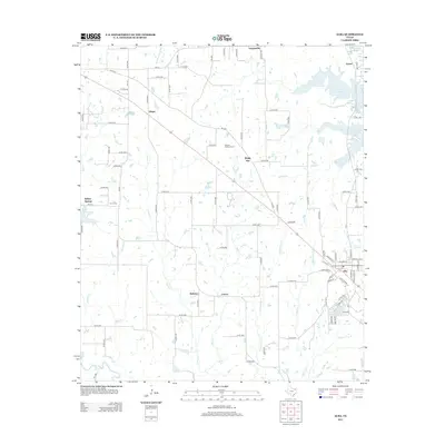
2012 Map of Alba
USGS Topo · Published 2012About this map
Alba serves as the primary community in this rural pocket of East Texas, where the landscape is defined by the branching tributaries of the Sabine River. A network of farm-to-market roads and county routes connects smaller, localized settlements such as Ginger, Bright Star, and Hogansville. The area's history is preserved in quiet landmarks like the Turner Cem near Willow Springs and the MaGee - McCord Cem further east. These small burial grounds and named crossroads reflect a long-standing agricultural and residential pattern that persists even as nearby water features like Case Lake and Woods Lake highlight the region's low-lying, creek-fed terrain. The distribution of homes along roads like FM-779 and FM-515 illustrates the gradual development of these unincorporated communities over the decades, centered around the drainage basins of Franks Cr and Allread Cr.
Find a feature on this map
105 named features on this map. Tap any name to fly to it.
Don’t see what you’re looking for? This feature index may not catch every label — zoom into the map to look around manually.
Map Details
Editions of this 2012 Alba Map
This is the sole edition of this map. No revisions or reprints were ever made.
Other maps of this area

1956 · Tyler
USGS Topo · 1:250,000

1956 · Emory
USGS Topo · 1:62,500

1958 · Arbala
USGS Topo · 1:24,000

1958 · Alba
USGS Topo · 1:24,000

1959 · Calvary
USGS Topo · 1:24,000

1959 · Golden
USGS Topo · 1:24,000

1959 · Grand Saline
USGS Topo · 1:24,000

1959 · Yantis
USGS Topo · 1:24,000

1959 · Grand Saline
USGS Topo · 1:62,500

1959 · Alba
USGS Topo · 1:62,500