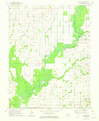
1971 Map of Albion NW
USGS Topo · Published 1973About this map
The Little Wabash River winds through this Illinois landscape, defining the border between Wayne and Edwards counties. In the early 1970s, the region was characterized by its river-bottom geography and an active extraction economy, notably seen in the Maple Grove Oil Field and Golden Gate North Oil Field. These industrial sites sit alongside long-established rural community centers, including Townhall and several country sanctuaries such as McKendree Chapel and Oak Grove Ch.
Find a feature on this map
41 named features on this map. Tap any name to fly to it.
Don’t see what you’re looking for? This feature index may not catch every label — zoom into the map to look around manually.
Map Details
Editions of this 1971 Albion NW Map
This is the sole edition of this map. No revisions or reprints were ever made.
Other maps of this area

1943 · Albion
USGS Topo · 1:62,500

1946 · Albion
USGS Topo · 1:62,500

1948 · Fairfield
USGS Topo · 1:62,500

1948 · Flora
USGS Topo · 1:62,500

1949 · Olney
USGS Topo · 1:62,500

1949 · Flora
USGS Topo · 1:62,500

1958 · Belleville
USGS Topo · 1:250,000

1962 · Belleville
USGS Topo · 1:250,000

1970 · Enterprise
USGS Topo · 1:24,000
1971 · Golden Gate
USGS Topo · 1:24,000