
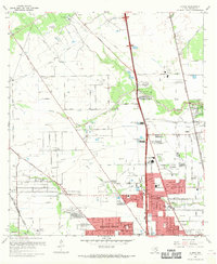
1967 Map of Aldine
USGS Topo · Published 1967About this map
Greens Bayou and Halls Bayou wind through this northern Harris County landscape, which in the late 1960s was transitioning from rural petroleum fields into a developing residential and institutional hub. The map highlights significant civic and military infrastructure, most notably the expansive Veterans Administration Cemetery. Educational centers like Aldine High Sch and Stovall Jr High Sch serve the growing communities of Aldine and Highland Heights. Transportation and communication define the area's layout, with Missouri Pacific rail lines and numerous pipelines crossing the territory. The presence of Collier Airport, Airman Field, and several radio towers, including those for Kenr and Kilt, reflects the mid-century aerospace and broadcast growth of the greater Houston region. Local history is further preserved through numerous family and community sites such as Rest Haven Cemetery and Prairie Garden Ch.
Find a feature on this map
79 named features on this map. Tap any name to fly to it.
Don’t see what you’re looking for? This feature index may not catch every label — zoom into the map to look around manually.
Map Details
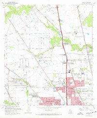
Editions of this 1967 Aldine Map
3 editions found
Other maps of this area

1915 · Houston Heights
USGS Topo · 1:24,000

1915 · Hillendahl
USGS Topo · 1:24,000

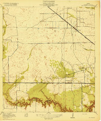
1916 · Aldine
USGS Topo · 1:24,000

1916 · Settegast
USGS Topo · 1:24,000

1916 · Louetta
USGS Topo · 1:24,000

1916 · Satsuma
USGS Topo · 1:24,000

1916 · Humble
USGS Topo · 1:24,000

1916 · Spring
USGS Topo · 1:24,000
1918 · Hillendahl
USGS Topo · 1:31,680
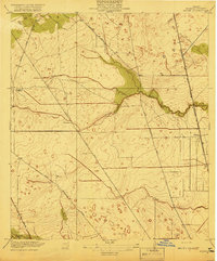
1919 · Aldine
USGS Topo · 1:31,680