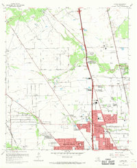
1967 Map of Aldine
USGS Topo · Published 1969About this map
Greens Bayou and Halls Bayou wind through this northern Harris County landscape, which shows a transition from rural oil fields to suburban residential expansion. The community of Aldine serves as a focal point, supported by institutional landmarks like the Aldine High Sch and Stovall Jr High Sch. To the south, the grid of Highland Heights is established near Vogel Creek, while several airfields including Airman Field and Collier Airport reflect the era's regional aviation growth. Genealogists will find a high concentration of burial grounds, notably the Veterans Administration Cemetery, Paradise Cem, and Cemetery Beautiful. Industrial elements remain prominent throughout the quadrangle, evidenced by numerous oil and gas wells, radio towers for Kenr and Kilt, and the steady tracks of the Missouri Pacific railroad.
Find a feature on this map
55 named features on this map. Tap any name to fly to it.
Don’t see what you’re looking for? This feature index may not catch every label — zoom into the map to look around manually.
Map Details
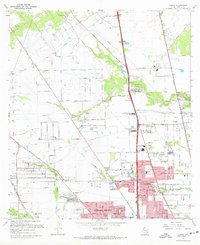
Editions of this 1967 Aldine Map
3 editions found

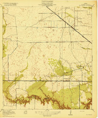
Other maps of this area

1915 · Houston Heights
USGS Topo · 1:24,000

1915 · Hillendahl
USGS Topo · 1:24,000

1916 · Aldine
USGS Topo · 1:24,000

1916 · Settegast
USGS Topo · 1:24,000

1916 · Louetta
USGS Topo · 1:24,000

1916 · Satsuma
USGS Topo · 1:24,000

1916 · Humble
USGS Topo · 1:24,000

1916 · Spring
USGS Topo · 1:24,000
1918 · Hillendahl
USGS Topo · 1:31,680
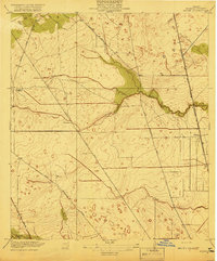
1919 · Aldine
USGS Topo · 1:31,680