
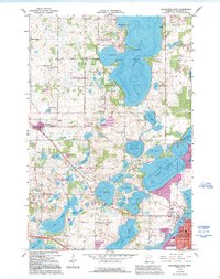
1966 Map of Alexandria West
USGS Topo · Published 1967About this map
Glacial lakes dominate the central Minnesota landscape west of Alexandria in the mid-1960s, a region defined by its water and woods. The intricate shorelines of Lake Ida and Lake Darling are shown with significant detail, including depth soundings and named points such as Stony Point and Breezy Point. This era shows the rural character of the area transitioning toward the growing county seat, with the Great Northern railroad corridor and a new pipeline cutting across the lake-strewn terrain of La Grand township. Local genealogy is well-preserved through numerous small burying grounds like St Lukes Cem and Kinkaid Cemetery, while the small village of Garfield serves as a western outpost on the rail line. Environmental conservation is evident in the sprawling National Wildlife Management Area and the La Grand State Wildlife Management Area, protecting the wetlands between Lake Brophy and Lake Louise.
Find a feature on this map
58 named features on this map. Tap any name to fly to it.
Don’t see what you’re looking for? This feature index may not catch every label — zoom into the map to look around manually.
Map Details
Editions of this 1966 Alexandria West Map
2 editions found
Other maps of this area

1953 · Brainerd
USGS Topo · 1:250,000

1953 · Saint Cloud
USGS Topo · 1:250,000

1957 · Brainerd
USGS Topo · 1:250,000

1957 · Saint Cloud
USGS Topo · 1:250,000

1958 · Saint Cloud
USGS Topo · 1:250,000

1958 · Brainerd
USGS Topo · 1:250,000

1965 · Brainerd
USGS Topo · 1:250,000

1966 · Brandon
USGS Topo · 1:24,000

1966 · Farwell
USGS Topo · 1:24,000

1966 · Lake Mary
USGS Topo · 1:24,000