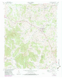
1958 Map of Alexandria
USGS Topo · Published 1983About this map
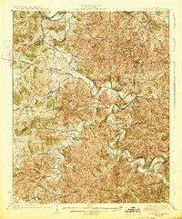
The town of Alexandria serves as a central hub on this mid-century survey of the Tennessee landscape, positioned at the junction of the Sparta Pike and Hickman Road. The terrain is defined by a dense network of hollows and branches, including Webb Hollow and Chumley Hollow, which feed into larger water bodies like Hickman Creek and the Smith Fork. The map documents a deeply rooted rural community, evidenced by numerous family-named landmarks and historical sites such as the Old Campground Cem and Liberty Hill Ch.
Find a feature on this map
45 named features on this map. Tap any name to fly to it.
Don’t see what you’re looking for? This feature index may not catch every label — zoom into the map to look around manually.
Map Details
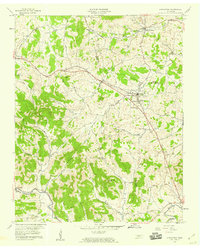
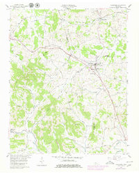
Editions of this 1958 Alexandria Map
3 editions found
Other maps of this area

1893 · Mc Minnville
USGS Topo · 1:125,000

1895 · Mc Minnville
USGS Topo · 1:125,000
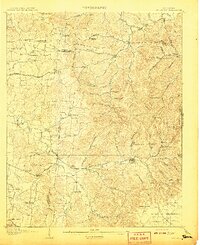
1908 · Woodbury
USGS Topo · 1:62,500
1928 · Gordonsville
USGS Topo · 1:62,500

1942 · Statesville
USGS Topo · 1:100,000

1953 · Chattanooga
USGS Topo · 1:250,000

1956 · Columbia
USGS Topo · 1:250,000

1956 · Corbin
USGS Topo · 1:250,000

1956 · Nashville
USGS Topo · 1:250,000

1957 · Chattanooga
USGS Topo · 1:250,000