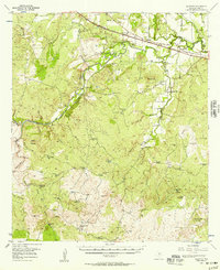
1956 Map of Algerita
USGS Topo · Published 1957About this map
San Saba River drainage defines the central landscape of this mid-1950s survey, where the river valley transitions into the elevated terrain of Brady Mountain and High Point Mountain. The corridor of the Gulf Colorado And Santa Fe (At & SF) railroad runs through the northern section, connecting the small communities of Algerita and Harkeyville. This era reflects a ranching and rural economy heavily dependent on water management, evidenced by the numerous named tanks and windmills, such as Thousand Dollar Tank and Kelley Windmill, scattered across the highlands and creek drainages like Wallace Creek.
Find a feature on this map
60 named features on this map. Tap any name to fly to it.
Don’t see what you’re looking for? This feature index may not catch every label — zoom into the map to look around manually.
Map Details
Editions of this 1956 Algerita Map
This is the sole edition of this map. No revisions or reprints were ever made.
Other maps of this area

1885 · San Saba
USGS Topo · 1:125,000

1887 · Llano
USGS Topo · 1:125,000

1887 · Mason
USGS Topo · 1:125,000

1894 · Brady
USGS Topo · 1:125,000

1894 · Mason
USGS Topo · 1:125,000

1894 · San Saba
USGS Topo · 1:125,000

1894 · Llano
USGS Topo · 1:125,000

1904 · Llano
USGS Topo · 1:125,000

1909 · Llano
USGS Topo · 1:125,000

1918 · Llano
USGS Topo · 1:125,000