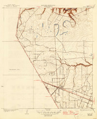
1932 Map of Algoa
USGS Topo · Published 1946About this map
Algoa stands as the primary hub on this coastal Texas prairie, situated at the significant junction where the Gulf Colorado and Santa Fe and Missouri Pacific railroads meet. Surveyed in 1929, the landscape is defined by the winding paths of Dickinson Bayou and Chigger Creek, which drainage patterns dictated early settlement and land use near the Brazoria and Galveston County lines. The map reveals a transition from these riparian corridors to an extensive Unsurveyed Area to the west, illustrating the limits of formal topographic recording in the early 20th century. Local researchers can trace the precise rail-and-river economy of the era, from the oxbows of Magnolia Creek to the northern reaches of Clear Cr, reflecting a time before modern suburban development altered the coastal plain.
Find a feature on this map
12 named features on this map. Tap any name to fly to it.
Don’t see what you’re looking for? This feature index may not catch every label — zoom into the map to look around manually.
Map Details
Editions of this 1932 Algoa Map
3 editions found
Other maps of this area

1916 · Genoa
USGS Topo · 1:24,000

1916 · Seabrook
USGS Topo · 1:24,000

1920 · Seabrook
USGS Topo · 1:31,680

1920 · Genoa
USGS Topo · 1:31,680

1920 · Mykawa
USGS Topo · 1:31,680

1929 · Dickinson
USGS Topo · 1:24,000

1929 · Algoa
USGS Topo · 1:24,000

1929 · Hitchcock
USGS Topo · 1:24,000

1932 · Algoa
USGS Topo · 1:31,680
1932 · Genoa
USGS Topo · 1:31,680