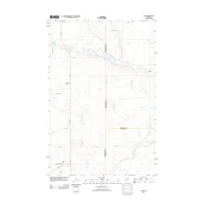
2013 Map of Alida
USGS Topo · Published 2013About this map
The Alida settlement serves as the focal point for this 2013 survey of the tri-county borderlands where Clearwater, Beltrami, and Hubbard counties meet. The landscape is defined by the headwaters of the Mississippi River and the smaller Little Mississippi River, which winds past Moose Lake in the north. Genealogists and local historians can find several key burial sites preserved here, including the Alida Cem near the town center, the Moose Creek Township Cem to the west, and the Jones Township Cem further east. A network of rural routes, such as Upper Rice Lake Rd and Mallard Grade Trl, connects these scattered sites through a wetland-rich terrain dotted with smaller water bodies like Dahlberg Lake and Crystal Lake. The map illustrates the persistent rural character of these northern townships, showing how the original county lines and local roads continue to shape the community's footprint decades after initial settlement.
Find a feature on this map
29 named features on this map. Tap any name to fly to it.
Don’t see what you’re looking for? This feature index may not catch every label — zoom into the map to look around manually.
Map Details
Editions of this 2013 Alida Map
This is the sole edition of this map. No revisions or reprints were ever made.
Other maps of this area

1919 · Solway
USGS Topo · 1:62,500

1943 · Solway
USGS Topo · 1:62,500

1943 · Bagley
USGS Topo · 1:62,500

1954 · Bemidji
USGS Topo · 1:250,000

1957 · Bemidji
USGS Topo · 1:250,000

1958 · Bemidji
USGS Topo · 1:250,000

1969 · Shevlin
USGS Topo · 1:24,000

1969 · Heart Lake
USGS Topo · 1:24,000
1969 · Upper Rice Lake
USGS Topo · 1:24,000

1972 · Alida
USGS Topo · 1:24,000