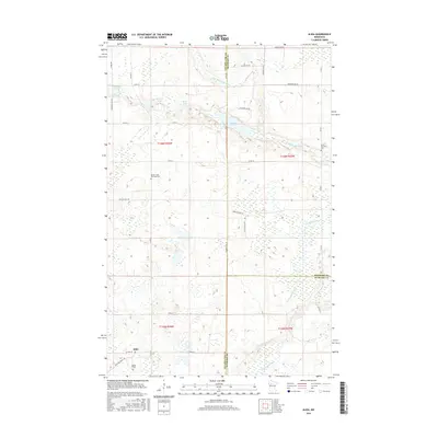
2016 Map of Alida
USGS Topo · Published 2016About this map
The Little Mississippi River and the headwaters of the Mississippi River define the terrain of this northern Minnesota landscape at the triple junction of Clearwater, Beltrami, and Hubbard counties. In the southwestern corner, the settlement of Alida serves as a local focal point, supported by the Alida Cem and the Mallard Grade Trl. The area is characterized by a high density of wetlands and small glacial lakes, including Dahlberg Lake, Duncan Lake, and Moose Lake. Genealogists will find particular value in the presence of the Jones Township Cem and Moose Creek Township Cem, which speak to the rural township organization of the early 21st century. The map also traces an intricate network of local county roads like Co Hwy 36 and Co Rd 10, illustrating the persistent rural infrastructure that connects these dispersed northern communities.
Find a feature on this map
42 named features on this map. Tap any name to fly to it.
Don’t see what you’re looking for? This feature index may not catch every label — zoom into the map to look around manually.
Map Details
Editions of this 2016 Alida Map
This is the sole edition of this map. No revisions or reprints were ever made.
Other maps of this area

1919 · Solway
USGS Topo · 1:62,500

1943 · Solway
USGS Topo · 1:62,500

1943 · Bagley
USGS Topo · 1:62,500

1954 · Bemidji
USGS Topo · 1:250,000

1957 · Bemidji
USGS Topo · 1:250,000

1958 · Bemidji
USGS Topo · 1:250,000

1969 · Shevlin
USGS Topo · 1:24,000

1969 · Heart Lake
USGS Topo · 1:24,000
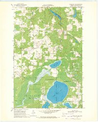
1969 · Upper Rice Lake
USGS Topo · 1:24,000

1972 · Alida
USGS Topo · 1:24,000