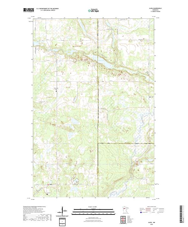
2022 Map of Alida
USGS Topo · Published 2022About this map
Alida serves as the focal point for this landscape in southern Clearwater County, situated near the intersection of Co Hwy 2 and Co Hwy 36. The terrain is defined by a dense network of glacial lakes and wetlands, including Moose Lake, Dahlberg Lake, and Duncan Lake. This area marks a significant hydrologic divide where the headwaters of the Mississippi River and the Little Mississippi River meander through the marshy lowlands. Local history is anchored by several rural burial grounds such as the Alida Cem, Moose Creek Township Cem, and Jones Township Cem, which reflect the early settlement patterns of the township. The presence of the Mallard Grade Trl and various county roads, including Raleigh Hill Rd and Clearline Rd NW, illustrates the modern transition from traditional logging and agricultural routes to recreational and local access ways.
Find a feature on this map
41 named features on this map. Tap any name to fly to it.
Don’t see what you’re looking for? This feature index may not catch every label — zoom into the map to look around manually.
Map Details
Editions of this 2022 Alida Map
This is the sole edition of this map. No revisions or reprints were ever made.
Other maps of this area

1919 · Solway
USGS Topo · 1:62,500

1943 · Solway
USGS Topo · 1:62,500

1943 · Bagley
USGS Topo · 1:62,500

1954 · Bemidji
USGS Topo · 1:250,000

1957 · Bemidji
USGS Topo · 1:250,000

1958 · Bemidji
USGS Topo · 1:250,000

1969 · Shevlin
USGS Topo · 1:24,000

1969 · Heart Lake
USGS Topo · 1:24,000
1969 · Upper Rice Lake
USGS Topo · 1:24,000

1972 · Alida
USGS Topo · 1:24,000