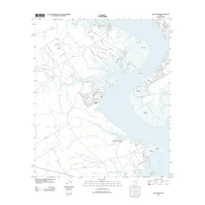
2012 Map of Allen Bend
USGS Topo · Published 2012About this map
Lake Whitney dominates this central Texas landscape, where the waters of the Brazos River form a complex shoreline of inlets and peninsulas. The residential community of Cedar Shores occupies a prominent point overlooking the reservoir, while Lakewood Harbor sits further south near the mouth of Long Br. The geography reflects the recreational and residential development that followed the damming of the river, with various parks like Cedron Creek Park and Walling Bend Park preserving public access to the waterfront. Higher ground features like Bee Bluff and the McCowan Valley offer distinct vantage points over the surrounding terrain. Traces of the area's older rural character remain visible through sites like Cedron Cem and the winding course of Cedron Cr, which feeds into the lake from the northwest. A dense network of local routes, including FM 56 and FM 1713, connects these lakeside settlements to the interior of Bosque County.
Find a feature on this map
103 named features on this map. Tap any name to fly to it.
Don’t see what you’re looking for? This feature index may not catch every label — zoom into the map to look around manually.
Map Details
Editions of this 2012 Allen Bend Map
This is the sole edition of this map. No revisions or reprints were ever made.
Other maps of this area

1888 · Meridian
USGS Topo · 1:125,000

1889 · Granbury
USGS Topo · 1:125,000

1891 · Cleburne
USGS Topo · 1:125,000

1892 · Waco
USGS Topo · 1:125,000

1894 · Meridian
USGS Topo · 1:125,000

1894 · Cleburne
USGS Topo · 1:125,000

1920 · Waco
USGS Topo · 1:125,000

1924 · Waco 2-b
USGS Topo · 1:48,000

1924 · Cleburne 3-C
USGS Topo · 1:48,000

1927 · Blum
USGS Topo · 1:62,500