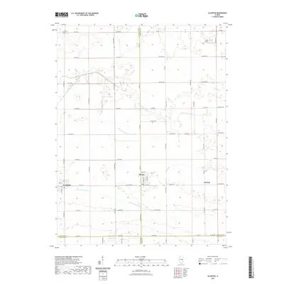
2021 Map of Allerton
USGS Topo · Published 2021About this map
Allerton and Broadlands anchor this landscape along the border of Champaign, Vermilion, and Douglas counties. This portion of east-central Illinois is defined by an extensive network of drainage features supporting its agricultural productivity, including the Little Vermilion Ditch, Little Vermilion Sub-Two-Ditch, and Jordan Slough. The topography is subtly divided by the headwaters of two major systems, with the Little Vermilion River flowing toward the Wabash and the E Br Embarras River draining south. Local history is marked by established sites such as Lost Grove Cem in the northwest and Hastings to the east. Small-scale infrastructure like the Trisler Airport and the grid of county roads, such as Co RD 2700 E and Co RD 200 N, illustrates the persistent rural character of the region.
Find a feature on this map
61 named features on this map. Tap any name to fly to it.
Don’t see what you’re looking for? This feature index may not catch every label — zoom into the map to look around manually.
Map Details
Editions of this 2021 Allerton Map
This is the sole edition of this map. No revisions or reprints were ever made.
Other maps of this area

1906 · Urbana
USGS Topo · 1:62,500

1931 · Fithian
USGS Topo · 1:48,000

1943 · Fithian
USGS Topo · 1:62,500

1953 · Danville
USGS Topo · 1:250,000

1953 · Indianapolis
USGS Topo · 1:250,000

1955 · Danville
USGS Topo · 1:250,000

1956 · Danville
USGS Topo · 1:250,000

1956 · Indianapolis
USGS Topo · 1:250,000

1956 · Newman
USGS Topo · 1:62,500

1956 · Villa Grove
USGS Topo · 1:62,500