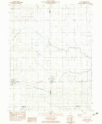
1982 Map of Allerton
USGS Topo · Published 1983About this map
Allerton and Broadlands anchor this early 1980s landscape, positioned along the straight transit line of the Missouri Pacific railroad. The geography is defined by the subtle drainage patterns of east-central Illinois, where the East Branch Embarras River and its accompanying Jordan Slu flow through the southern townships of Newman and Young America. To the north, the Little Vermilion River and the Little Vermilion Ditch mark the transition into South Homer and Jamaica. This survey reveals a high degree of agricultural organization, with rural school sites like Sch No 6 and the isolated Lost Grove Cem serving as landmarks within the grid. The intersection of three counties — Champaign, Vermilion, and Douglas — creates a complex jurisdictional patchwork across the settlements and agricultural fields of Ayers and Sidell.
Find a feature on this map
21 named features on this map. Tap any name to fly to it.
Don’t see what you’re looking for? This feature index may not catch every label — zoom into the map to look around manually.
Map Details
Editions of this 1982 Allerton Map
This is the sole edition of this map. No revisions or reprints were ever made.
Other maps of this area

1906 · Urbana
USGS Topo · 1:62,500

1931 · Fithian
USGS Topo · 1:48,000

1943 · Fithian
USGS Topo · 1:62,500

1953 · Danville
USGS Topo · 1:250,000

1953 · Indianapolis
USGS Topo · 1:250,000

1955 · Danville
USGS Topo · 1:250,000

1956 · Danville
USGS Topo · 1:250,000

1956 · Indianapolis
USGS Topo · 1:250,000

1956 · Newman
USGS Topo · 1:62,500

1956 · Villa Grove
USGS Topo · 1:62,500