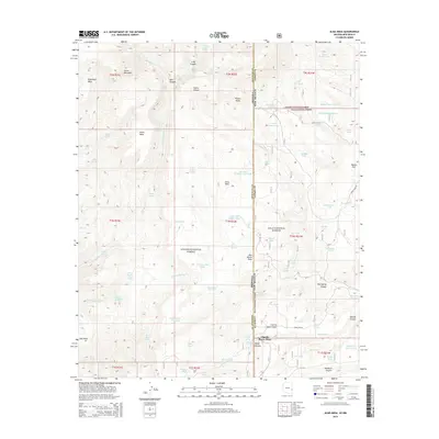
2014 Map of Alma Mesa
USGS Topo · Published 2014About this map
Charlie Moore Place stands as a primary point of human reference in this high-desert borderland where the Apache National Forest meets the Gila National Forest. The landscape is defined by its complex topography of mesas and canyons, including the prominent Horse Mountain and the distinctively named Bonehead Mesa to the northwest. This 2014 survey documents the remote transition between Greenlee County, Arizona, and Catron County, New Mexico, a region where water management is critical for land use, as evidenced by dozens of named tanks and springs like White Yams Spring and Little Blue Spring. The drainage patterns of Little Blue Cr and Ash Cr carve through the plateau, creating deep features such as Banjo Canyon and Keller Canyon. Isolated ranching or forest service infrastructure is represented by routes like Cradle Mesa Rd and Forest Rd 104, connecting the few named flats and mesas across the state line.
Find a feature on this map
88 named features on this map. Tap any name to fly to it.
Don’t see what you’re looking for? This feature index may not catch every label — zoom into the map to look around manually.
Map Details
Editions of this 2014 Alma Mesa Map
This is the sole edition of this map. No revisions or reprints were ever made.
Other maps of this area

1910 · Mogollon
USGS Topo · 1:125,000

1912 · Mogollon
USGS Topo · 1:125,000

1913 · Morenci
USGS Topo · 1:125,000

1915 · Morenci
USGS Topo · 1:125,000

1915 · Reserve
USGS Topo · 1:125,000

1918 · Reserve
USGS Topo · 1:125,000

1922 · Nutrioso
USGS Topo · 1:125,000

1954 · Clifton
USGS Topo · 1:250,000

1957 · Clifton
USGS Topo · 1:250,000

1958 · Clifton
USGS Topo · 1:250,000