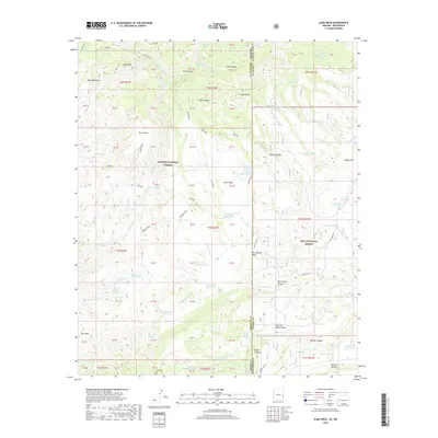
2018 Map of Alma Mesa
USGS Topo · Published 2018About this map
Alma Mesa dominates this high-altitude landscape along the border of Greenlee Co and Catron Co, where the Apache National Forest meets the Gila National Forest. The map documents a complex network of canyons and water-management features essential for ranching and forest management, including numerous stock tanks like Stateline Tank and Cradle Mesa Tank. A significant topographical transition occurs as the terrain drops from Horse Mtn and Bonehead Mesa toward the Zuni Basin. Historic paths and fire roads such as the Hannah Trail and Forest Rd 711 traverse the ridges, linking secluded springs like White Yam Spring and Two-Timing Spring. The intricate drainage systems of Little Blue Cr and Beaver Canyon suggest the seasonal flow patterns of this arid upland environment, while landmarks like Charlie Moore Mesa provide a record of local family associations with the land.
Find a feature on this map
104 named features on this map. Tap any name to fly to it.
Don’t see what you’re looking for? This feature index may not catch every label — zoom into the map to look around manually.
Map Details
Editions of this 2018 Alma Mesa Map
This is the sole edition of this map. No revisions or reprints were ever made.
Other maps of this area

1910 · Mogollon
USGS Topo · 1:125,000

1912 · Mogollon
USGS Topo · 1:125,000

1913 · Morenci
USGS Topo · 1:125,000

1915 · Morenci
USGS Topo · 1:125,000

1915 · Reserve
USGS Topo · 1:125,000

1918 · Reserve
USGS Topo · 1:125,000

1922 · Nutrioso
USGS Topo · 1:125,000

1954 · Clifton
USGS Topo · 1:250,000

1957 · Clifton
USGS Topo · 1:250,000

1958 · Clifton
USGS Topo · 1:250,000