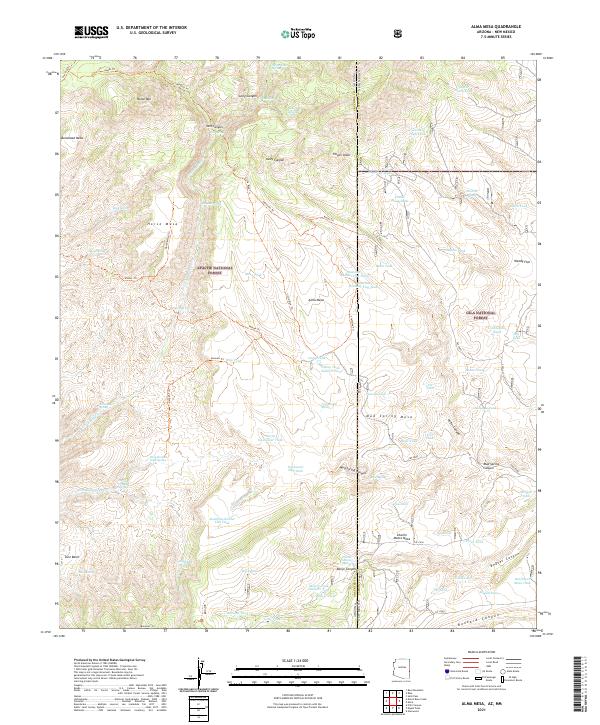
2021 Map of Alma Mesa
USGS Topo · Published 2021About this map
Apache National Forest and Gila National Forest converge at the Arizona-New Mexico state line in this survey of high-elevation tablelands and canyon systems. The landscape is defined by massive landforms like Alma Mesa and Horse Mesa, dissected by drainages such as Kelly Canyon and Beaver Canyon. A dense network of remote water sources, including White Yams Spring, Dirty Hannah Creek Spring, and Two-Timing Spring, suggests a territory managed for livestock grazing and wildlife within the national forests.
Find a feature on this map
91 named features on this map. Tap any name to fly to it.
Don’t see what you’re looking for? This feature index may not catch every label — zoom into the map to look around manually.
Map Details
Editions of this 2021 Alma Mesa Map
This is the sole edition of this map. No revisions or reprints were ever made.
Other maps of this area

1910 · Mogollon
USGS Topo · 1:125,000

1912 · Mogollon
USGS Topo · 1:125,000

1913 · Morenci
USGS Topo · 1:125,000

1915 · Morenci
USGS Topo · 1:125,000

1915 · Reserve
USGS Topo · 1:125,000

1918 · Reserve
USGS Topo · 1:125,000

1922 · Nutrioso
USGS Topo · 1:125,000

1954 · Clifton
USGS Topo · 1:250,000

1957 · Clifton
USGS Topo · 1:250,000

1958 · Clifton
USGS Topo · 1:250,000