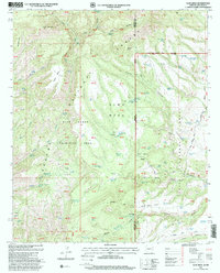
1997 Map of Alma Mesa
USGS Topo · Published 2000About this map
The Arizona-New Mexico border country is defined here by the high desert topography of the Apache National Forest and Gila National Forest. This 1997 revision shows a landscape dominated by massive flat-topped features like Alma Mesa, Bonehead Mesa, and Charlie Moore Mesa, interspersed with vital water sources such as Magnet Spring and Vee Spring. The infrastructure of the ranching era is evident in the network of stock tanks like Tomcat Tank and Hobbled Steer Tank, alongside the Cradle-Mesa Corral. The Charlie Moore Place stands as a solitary named settlement, marking human presence in a territory largely preserved as the Apache Blue Range Primitive Area. The map details the transition from high points like Horse Mountain down to the drainage of Blue Creek, illustrating how geography dictated travel and resource management in this borderland.
Find a feature on this map
85 named features on this map. Tap any name to fly to it.
Don’t see what you’re looking for? This feature index may not catch every label — zoom into the map to look around manually.
Map Details
Editions of this 1997 Alma Mesa Map
This is the sole edition of this map. No revisions or reprints were ever made.
Other maps of this area

1910 · Mogollon
USGS Topo · 1:125,000

1912 · Mogollon
USGS Topo · 1:125,000

1913 · Morenci
USGS Topo · 1:125,000

1915 · Morenci
USGS Topo · 1:125,000

1915 · Reserve
USGS Topo · 1:125,000

1918 · Reserve
USGS Topo · 1:125,000

1922 · Nutrioso
USGS Topo · 1:125,000

1954 · Clifton
USGS Topo · 1:250,000

1957 · Clifton
USGS Topo · 1:250,000

1958 · Clifton
USGS Topo · 1:250,000