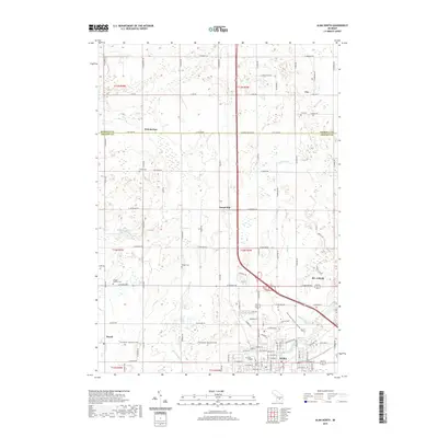
2019 Map of Alma North
USGS Topo · Published 2019About this map
The Alma and St. Louis corridor in central Michigan is defined by a dense grid of rural roads and the winding path of the Pine River. This landscape, spanning the border of Isabella and Gratiot counties, highlights the proximity of Alma College to the residential and industrial outskirts of the two neighboring cities. The drainage patterns of Salt Creek, Little Salt Creek, and Honeyoey Creek reflect the agricultural nature of the land between smaller settlements like Forest Hill and Summerton. Local genealogy is well-supported by several smaller burial grounds, including Brady Cemetery, Wright Cemetery, and Coe Cemetery, which are scattered among the farmsteads and sections. The presence of Madison Lake and various smaller water bodies provide a break in the geometric township and range layout that dominates this region.
Find a feature on this map
105 named features on this map. Tap any name to fly to it.
Don’t see what you’re looking for? This feature index may not catch every label — zoom into the map to look around manually.
Map Details
Editions of this 2019 Alma North Map
This is the sole edition of this map. No revisions or reprints were ever made.
Other maps of this area

1916 · Mount Pleasant
USGS Topo · 1:62,500

1919 · Mount Pleasant
USGS Topo · 1:62,500

1930 · Shepherd
USGS Topo · 1:48,000

1935 · Alma
USGS Topo · 1:62,500

1936 · Shepherd
USGS Topo · 1:62,500

1938 · Alma
USGS Topo · 1:62,500

1943 · Mount Pleasant
USGS Topo · 1:62,500

1954 · Midland
USGS Topo · 1:250,000

1958 · Midland
USGS Topo · 1:250,000

1959 · Midland
USGS Topo · 1:250,000