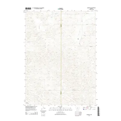
2014 Map of Almeria SW
USGS Topo · Published 2014About this map
The border of Blaine Co and Loup Co divides this quiet ranching landscape in the Nebraska Sandhills. The terrain is defined by the sweeping depressions of Dry Valley, where the complex topography of the dunes meets the sparse infrastructure of the high plains. Human activity is centered on widely spaced cattle ranching operations, represented by the isolated Mc Millan Ranch Airport in the southwestern corner. A network of rural section-line roads, including 440th Ave and Dry Valley Rd, provides the primary framework for movement across the undulating hills. These routes connect various ranch outposts and family-owned properties, maintaining the long-standing land-use patterns of this central Nebraska region. The absence of concentrated settlements emphasizes the enduring agricultural and pastoral character of the area well into the twenty-first century.
Find a feature on this map
10 named features on this map. Tap any name to fly to it.
Don’t see what you’re looking for? This feature index may not catch every label — zoom into the map to look around manually.
Map Details
Editions of this 2014 Almeria SW Map
This is the sole edition of this map. No revisions or reprints were ever made.
Other maps of this area

1951 · Walworth
USGS Topo · 1:24,000

1951 · Anselmo NE
USGS Topo · 1:24,000

1951 · Milburn
USGS Topo · 1:24,000

1952 · Brewster
USGS Topo · 1:24,000

1952 · Almeria NE
USGS Topo · 1:24,000

1952 · Almeria NW
USGS Topo · 1:24,000

1952 · Almeria SW
USGS Topo · 1:24,000

1952 · Brewster SE
USGS Topo · 1:24,000

1952 · Almeria
USGS Topo · 1:24,000

1955 · Broken Bow
USGS Topo · 1:250,000