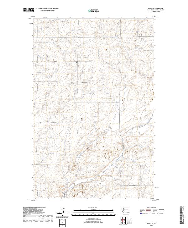
2023 Map of Almira SE
USGS Topo · Published 2023About this map
Tolonen Cem sits at a high point in this corner of Lincoln County, marking a site of local genealogical interest within a landscape of dry-land agriculture and rolling topography. The survey reveals a grid of rural section roads named for early families, such as Monson Rd, Kuchenbuch Rd, and Schweda Rd, which delineate the farmsteads and field patterns of the region. The drainage of Canniwal Creek winds through the southern reaches of the map, occasionally pooling at Carpenter Lake. This area of Washington is characterized by its organized survey lines and the sparse, purposeful placement of water sources and burial grounds, providing a clear view of how the land has been partitioned and managed into the early 21st century.
Find a feature on this map
33 named features on this map. Tap any name to fly to it.
Don’t see what you’re looking for? This feature index may not catch every label — zoom into the map to look around manually.
Map Details
Editions of this 2023 Almira SE Map
This is the sole edition of this map. No revisions or reprints were ever made.
Other maps of this area

1953 · Ritzville
USGS Topo · 1:250,000

1959 · Ritzville
USGS Topo · 1:250,000

1965 · Ritzville
USGS Topo · 1:250,000

1968 · Marlin
USGS Topo · 1:24,000

1968 · Pacific Lake
USGS Topo · 1:24,000

1968 · Sullivan Lake
USGS Topo · 1:24,000

1969 · Almira
USGS Topo · 1:24,000

1969 · Almira SE
USGS Topo · 1:24,000
1969 · Almira SW
USGS Topo · 1:24,000

1969 · Govan
USGS Topo · 1:24,000