
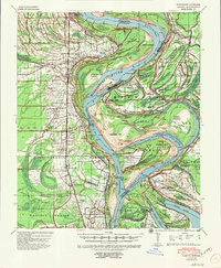
1939 Map of Alsatia
USGS Topo · Published 1953About this map
The Mississippi River dominates this landscape along the border of Louisiana and Mississippi, revealing the dynamic evolution of the river's channel through massive engineering works. The map documents several significant alterations to the river's path, including the Newman Cut-Off and the Willow Cut-Off, which left behind dramatic oxbows and landforms like Albemarle Bend and Eagle Lake. On the western bank in East Carroll Parish, the Missouri Pacific railroad serves a string of agricultural settlements such as Alsatia, Sondheimer, and Transylvania. These communities are situated among a complex network of drainage canals and bayous, such as Little Tensas Bayou and Otter Bayou. Evidence of the region's ancient history is visible at Indian Mounds near Mt Chapel Ch, while more recent environmental history is marked by the Hollybrook Crevasse and Salem Crevasse, indicating the persistent threat of river flooding.
Find a feature on this map
62 named features on this map. Tap any name to fly to it.
Don’t see what you’re looking for? This feature index may not catch every label — zoom into the map to look around manually.
Map Details
Editions of this 1939 Alsatia Map
2 editions found
Other maps of this area

1909 · Baxter Bayou
USGS Topo · 1:24,000

1909 · Millikens Bend
USGS Topo · 1:24,000

1909 · Lake Providence
USGS Topo · 1:24,000

1909 · Tallulah
USGS Topo · 1:24,000

1911 · Lake Providence
USGS Topo · 1:31,680

1911 · Baxter Bayou
USGS Topo · 1:24,000

1914 · Baxter Bayou
USGS Topo · 1:31,680

1918 · Vicksburg
USGS Topo · 1:62,500

1935 · Waverly
USGS Topo · 1:62,500

1935 · Oak Grove
USGS Topo · 1:62,500