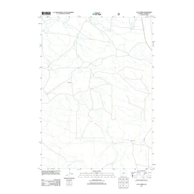
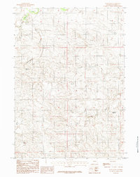
2012 Map of Alta Creek
USGS Topo · Published 2012About this map
Dry Fork Cheyenne River snakes across the southern portion of this landscape in Converse County, where the high plains meet a network of ephemeral drainages. The area is defined by its wide, open terrain and ranching heritage, notably centered around the Morton Ranch in the southeast. North of the river, the elevation rises toward Dilts Flat, a broad plateau flanked by the seasonal headwaters of Alta Cr. The map captures a contemporary look at rural Wyoming land management, showing the reach of the Usfs 961 forest service road as it provides access to the northern reaches near Lonetree Cr and Bear Cr. This 2012 survey illustrates the sparse, sprawling nature of the region, where water courses and ranching infrastructure remain the primary markers of human presence.
Find a feature on this map
7 named features on this map. Tap any name to fly to it.
Don’t see what you’re looking for? This feature index may not catch every label — zoom into the map to look around manually.
Map Details
Editions of this 2012 Alta Creek Map
This is the sole edition of this map. No revisions or reprints were ever made.
Other maps of this area

1955 · Newcastle
USGS Topo · 1:250,000

1958 · Newcastle
USGS Topo · 1:250,000

1959 · Bill
USGS Topo · 1:62,500

1959 · Betty Reservoir
USGS Topo · 1:62,500

1959 · Coal Draw
USGS Topo · 1:62,500
1959 · Highland Flats
USGS Topo · 1:62,500

1979 · Bill
USGS Topo · 1:100,000
1984 · Dugout Creek North
USGS Topo · 1:24,000
1984 · Coal Draw North
USGS Topo · 1:24,000
1984 · Patsy Draw
USGS Topo · 1:24,000