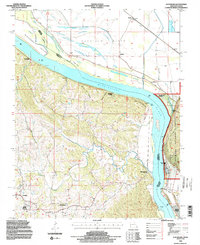
1994 Map of Altenburg
USGS Topo · Published 1996About this map
The Mississippi River dominates this landscape, defining the winding boundary between Missouri and Illinois. On the Missouri side, the settlements of Altenburg and Frohna represent established communities in Perry County, set amidst a complex network of ridges and drainages like Brazeau Creek. The riverfront is marked by various river-access points and geographic landmarks, including Leimbach Landing, Brunkhorst Landing, and the prominent Tower Rock near the southern bend. Across the water in Illinois, the lowlands of Fountain Bluff and the Shawnee National Forest contrast with the rugged bluffs of the western shore.
Find a feature on this map
36 named features on this map. Tap any name to fly to it.
Don’t see what you’re looking for? This feature index may not catch every label — zoom into the map to look around manually.
Map Details
Editions of this 1994 Altenburg Map
2 editions found
Other maps of this area

1910 · Murphysboro
USGS Topo · 1:62,500

1916 · Campbell Hill
USGS Topo · 1:62,500

1918 · Altenburg
USGS Topo · 1:62,500

1918 · Campbell Hill
USGS Topo · 1:62,500

1924 · Alto Pass
USGS Topo · 1:62,500

1925 · Altenburg
USGS Topo · 1:62,500

1938 · Murphysboro
USGS Topo · 1:62,500

1947 · Alto Pass
USGS Topo · 1:62,500

1947 · Crosstown
USGS Topo · 1:24,000

1947 · Oak Ridge
USGS Topo · 1:24,000