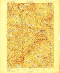
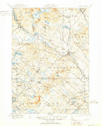
1919 Map of Alton
USGS Topo · Published 1919About this map
Alton Bay marks the southeastern reach of Lake Winnipesaukee in this 1917 survey, serving as a vital rail terminus for the Boston and Maine RR. The landscape is a network of small, interconnected villages and crossroads like Stockbridge Corners, Dexter Corner, and Leighton Corners that characterize early 20th-century Strafford County. Local life was anchored by scattered educational institutions such as the Pearl School, Tasker School, and Ware Road School.
Find a feature on this map
111 named features on this map. Tap any name to fly to it.
Don’t see what you’re looking for? This feature index may not catch every label — zoom into the map to look around manually.
Map Details
Editions of this 1919 Alton Map
6 editions found

Other maps of this area

1891 · Berwick
USGS Topo · 1:62,500

1891 · Newfield
USGS Topo · 1:62,500

1893 · Dover
USGS Topo · 1:62,500

1893 · Berwick
USGS Topo · 1:62,500

1893 · Newfield
USGS Topo · 1:62,500

1909 · Winnepesaukee
USGS Topo · 1:62,500

1916 · Dover
USGS Topo · 1:62,500

1917 · Mt. Pawtuckaway
USGS Topo · 1:62,500

1918 · Dover
USGS Topo · 1:62,500

1919 · Mt. Pawtuckaway
USGS Topo · 1:62,500