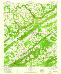
1958 Map of Altoona
USGS Topo · Published 1960About this map
Altoona and Walnut Grove anchor this 1950s survey of the intersection between the Blount and Etowah county lines. The landscape is defined by the sharp ridges of Sand Mountain, Red Mountain, and Straight Mountain, which channel local movement through gaps like Silver Gap and Tanyard Gap. The economic life of the era is visible in the industrial footprint of Strip mines near the Louisville and Nashville RR and the Nashville and Chattanooga RR. Numerous community landmarks, including Snead Chapel, New Emmaus Ch, and the Altoona-Walnut Grove Cemetery, are plotted alongside rural intersections such as Ellison Crossroads. Water flows through the valley floor via the Locust Fork of the Black Warrior River, which is crossed by the Thompson Bridge, while smaller features like Minnow ponds and Hanna Pond dot the agricultural landscape between the mountains.
Find a feature on this map
68 named features on this map. Tap any name to fly to it.
Don’t see what you’re looking for? This feature index may not catch every label — zoom into the map to look around manually.
Map Details
Editions of this 1958 Altoona Map
3 editions found
Other maps of this area

1885 · Gadsden
USGS Topo · 1:125,000

1888 · Gadsden
USGS Topo · 1:125,000

1889 · Springville
USGS Topo · 1:125,000

1892 · Springville
USGS Topo · 1:125,000

1892 · Gadsden
USGS Topo · 1:125,000

1895 · Gadsden
USGS Topo · 1:125,000

1903 · Gadsden
USGS Topo · 1:125,000

1936 · Mountainboro
USGS Topo · 1:24,000
1936 · Brooksville
USGS Topo · 1:24,000

1936 · High Point
USGS Topo · 1:24,000