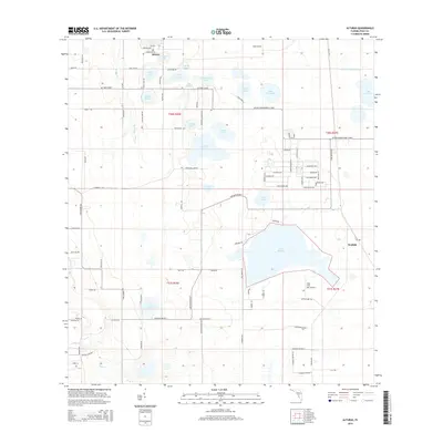
2015 Map of Alturas
USGS Topo · Published 2015About this map
The settlement of Alturas serves as the focal point for this interior Florida landscape, defined by an intricate network of freshwater lakes and drainage systems. This 2015 survey illustrates a region where citrus agriculture and residential expansion meet, with Orange Ranch and small landing strips like the Villa Char Mar Airport situated among the numerous water bodies. The hydrology is dominated by named basins such as Lake Buffum, Lake Henry, and the cluster near the town center including Crystal Lake and Star Lake. These lakes are connected and managed through features like the Peace Cr Drainage Canal, while smaller streams such as Boggy Br and Sink Br drain the surrounding terrain. Local history and genealogy researchers will find a detailed grid of rural roads, including Sinkhole Rd and Alturas Rd S, which provide access to the various lakefront settlements and the community of Wolfolk in the east.
Find a feature on this map
101 named features on this map. Tap any name to fly to it.
Don’t see what you’re looking for? This feature index may not catch every label — zoom into the map to look around manually.
Map Details
Editions of this 2015 Alturas Map
This is the sole edition of this map. No revisions or reprints were ever made.
Other maps of this area

1949 · Bartow
USGS Topo · 1:24,000

1950 · Bartow
USGS Topo · 1:24,000

1952 · Homeland
USGS Topo · 1:24,000

1952 · Lake Wales
USGS Topo · 1:24,000

1952 · Babson Park
USGS Topo · 1:24,000

1953 · Frostproof
USGS Topo · 1:24,000

1955 · Eloise
USGS Topo · 1:24,000

1955 · Bowling Green
USGS Topo · 1:24,000

1955 · Alturas
USGS Topo · 1:24,000

1956 · Bereah
USGS Topo · 1:24,000