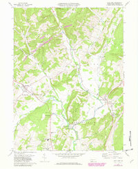
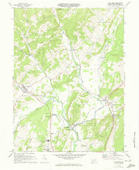
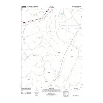
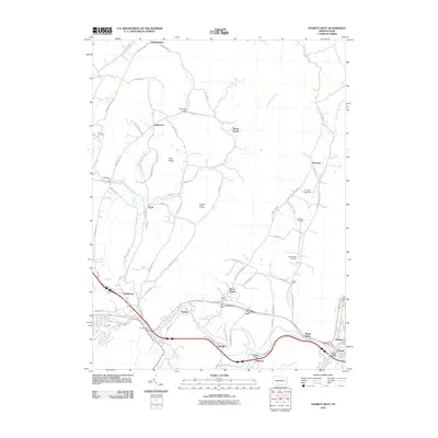
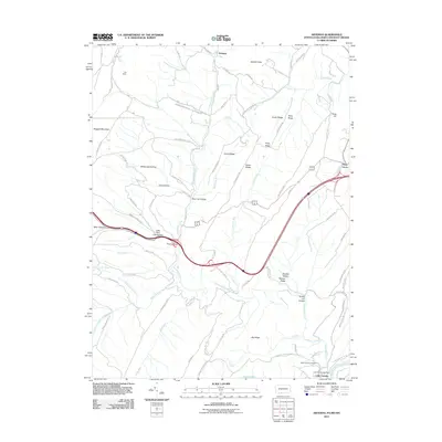
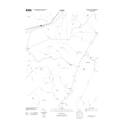
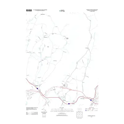
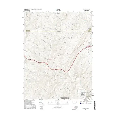
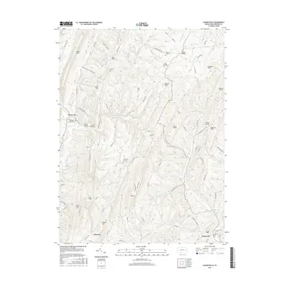
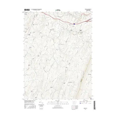
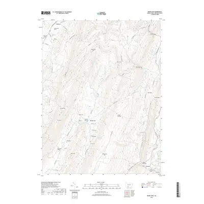
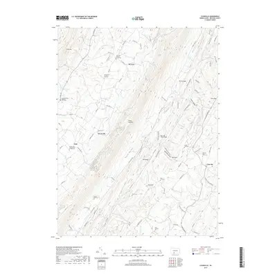
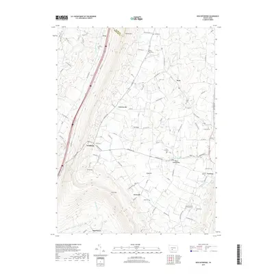
1971 Map of Alum Bank
USGS Topo · Published 1982About this map
Bobs Creek and Dunning Creek carve through the parallel ridges of Bedford County, defining a landscape of narrow agricultural valleys and steep timbered slopes. Along the valley floors, the settlements of Alum Bank, Osterburg, and St Clairsville are connected by a network of local roads and the Conrail line following the water gaps. This 1970s record shows the rural infrastructure of the era, including several instances of a Covered Bridge crossing the creeks and the established Fish Hatchery at Reynoldsdale. Genealogists will find notable local landmarks such as Horne Ch, St Peters Ch, and the Friends Cem near Spring Meadow, while the presence of several Sandpit locations in Lincoln township points to the local extractive industry of the time.
Find a feature on this map
42 named features on this map. Tap any name to fly to it.
Don’t see what you’re looking for? This feature index may not catch every label — zoom into the map to look around manually.
Map Details
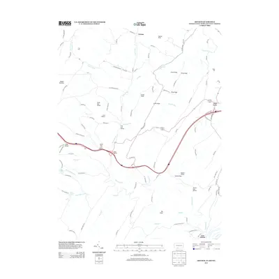
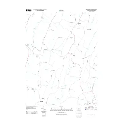
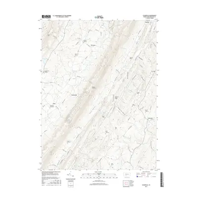
Editions of this 1971 Alum Bank Map
3 editions found
Historical Maps of Pavia Township Through Time
76 maps found

1908 Bedford
Bedford County, PA

1910 Bedford
Bedford County, PA

1927 Clearville
Bedford County, PA

1931 Clearville
Bedford County, PA

1944 Clearville
Bedford County, PA

1950 Artemas
Bedford County, PA

1967 Beans Cove
Bedford County, PA

1967 Buffalo Mills
Bedford County, PA

1967 Clearville
Bedford County, PA

1967 Mench
Bedford County, PA

1968 Chaneysville
Bedford County, PA

1968 Everett East
Bedford County, PA

1968 Everett West
Bedford County, PA

1968 New Enterprise
Bedford County, PA

1971 Alum Bank
Bedford County, PA

1971 Bedford
Bedford County, PA

1971 Ogletown
Bedford County, PA

1977 Ogletown
Bedford County, PA

1994 Everett East
Bedford County, PA

1994 Mench
Bedford County, PA
2010 Beans Cove
Bedford County, PA
2010 Bedford
Bedford County, PA
2010 Buffalo Mills
Bedford County, PA
2010 Chaneysville
Bedford County, PA
2010 Clearville
Bedford County, PA
2010 Everett East
Bedford County, PA
2010 Everett West
Bedford County, PA
2010 Mench
Bedford County, PA
2010 New Enterprise
Bedford County, PA
2010 Ogletown
Bedford County, PA
2011 Artemas
Bedford County, PA
2013 Artemas
Bedford County, PA
2013 Beans Cove
Bedford County, PA
2013 Bedford
Bedford County, PA
2013 Buffalo Mills
Bedford County, PA
2013 Chaneysville
Bedford County, PA
2013 Clearville
Bedford County, PA
2013 Everett East
Bedford County, PA
2013 Everett West
Bedford County, PA
2013 Mench
Bedford County, PA
2013 New Enterprise
Bedford County, PA
2013 Ogletown
Bedford County, PA
2016 Artemas
Bedford County, PA
2016 Beans Cove
Bedford County, PA
2016 Bedford
Bedford County, PA
2016 Buffalo Mills
Bedford County, PA
2016 Chaneysville
Bedford County, PA
2016 Clearville
Bedford County, PA
2016 Everett East
Bedford County, PA
2016 Everett West
Bedford County, PA
2016 Mench
Bedford County, PA
2016 New Enterprise
Bedford County, PA
2016 Ogletown
Bedford County, PA
2019 Artemas
Bedford County, PA
2019 Beans Cove
Bedford County, PA
2019 Bedford
Bedford County, PA
2019 Buffalo Mills
Bedford County, PA
2019 Chaneysville
Bedford County, PA
2019 Clearville
Bedford County, PA
2019 Everett East
Bedford County, PA
2019 Everett West
Bedford County, PA
2019 Mench
Bedford County, PA
2019 New Enterprise
Bedford County, PA
2019 Ogletown
Bedford County, PA

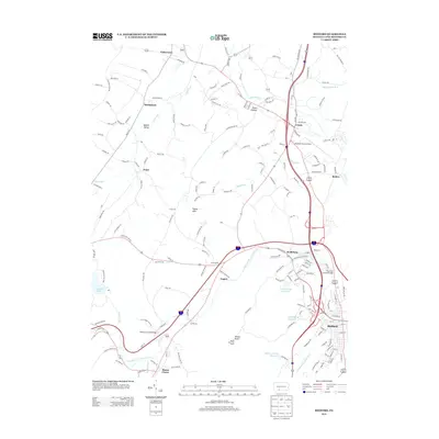
2023 Alum Bank
Bedford County, PA

2023 Artemas
Bedford County, PA

2023 Beans Cove
Bedford County, PA

2023 Bedford
Bedford County, PA

2023 Buffalo Mills
Bedford County, PA

2023 Chaneysville
Bedford County, PA

2023 Clearville
Bedford County, PA

2023 Everett East
Bedford County, PA

2023 Everett West
Bedford County, PA

2023 Mench
Bedford County, PA

2023 New Enterprise
Bedford County, PA

2023 Ogletown
Bedford County, PA
Featured Locations
- East Saint Clair Township, PA
- Pavia Township, PA
- King Township, PA
- Saint Clairsville, PA
- Churchville, East Saint Clair Township