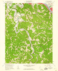
1958 Map of Alum Creek
USGS Topo · Published 1960About this map
The Coal River and Kanawha River converge in this 1950s study of the terrain south of Saint Albans. The landscape is defined by the winding course of the Coal, where small communities like Upper Falls (Tornado PO) and Alum Creek developed along the narrow river valleys. The presence of the Forks of Coal Memorial Park and the intersection of the New York Central and Chesapeake and Ohio railroads near Dunbar highlight the region's historical importance as a transit corridor. Local life is documented through numerous rural landmarks, including Browns Chapel, District High Sch, and family burial sites like Bryan Cem and Henley Cem. The map captures a transition from the industrial riverfronts in the north to the more secluded branches and forks of the south, such as Little Alum Creek and Fuquay Creek.
Find a feature on this map
66 named features on this map. Tap any name to fly to it.
Don’t see what you’re looking for? This feature index may not catch every label — zoom into the map to look around manually.
Map Details
Editions of this 1958 Alum Creek Map
3 editions found
Other maps of this area

1899 · Charleston
USGS Topo · 1:125,000

1909 · Charleston
USGS Topo · 1:62,500

1909 · Peytona
USGS Topo · 1:48,000

1909 · Saint Albans
USGS Topo · 1:62,500

1911 · Peytona
USGS Topo · 1:62,500

1911 · Madison
USGS Topo · 1:62,500

1929 · Madison
USGS Topo · 1:62,500

1929 · Peytona
USGS Topo · 1:62,500

1931 · Madison
USGS Topo · 1:62,500

1931 · Saint Albans
USGS Topo · 1:62,500