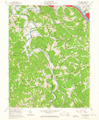
1958 Map of Alum Creek
USGS Topo · Published 1967About this map
The Coal River meanders through the hills of Kanawha and Lincoln counties, converging with the Little Coal River at the community of Forks of Coal. This 1950s survey captures a landscape of small riverbank settlements and ridge-top institutions, including Upper Falls (Tornado PO) and the busy industrial outskirts of Saint Albans. The area's social fabric is visible through a dense network of country schools and churches, such as Andrews Heights Sch, New Hope Ch, and Browns Chapel.
Find a feature on this map
55 named features on this map. Tap any name to fly to it.
Don’t see what you’re looking for? This feature index may not catch every label — zoom into the map to look around manually.
Map Details
Editions of this 1958 Alum Creek Map
3 editions found
Other maps of this area

1899 · Charleston
USGS Topo · 1:125,000

1909 · Charleston
USGS Topo · 1:62,500

1909 · Peytona
USGS Topo · 1:48,000

1909 · Saint Albans
USGS Topo · 1:62,500

1911 · Peytona
USGS Topo · 1:62,500

1911 · Madison
USGS Topo · 1:62,500

1929 · Madison
USGS Topo · 1:62,500

1929 · Peytona
USGS Topo · 1:62,500

1931 · Madison
USGS Topo · 1:62,500

1931 · Saint Albans
USGS Topo · 1:62,500