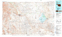
1990 Map of Alva
USGS Topo · Published 1990About this map
The Salt Fork Arkansas River and Cimarron River dominate this 1990 survey of the borderlands between Oklahoma and Kansas. The landscape is defined by the massive Great Salt Plains Reservoir and the surrounding National Wildlife Refuge, a critical ecological marker for the region. Significant transit infrastructure is visible, including the Atchison Topeka and Santa Fe railroad line and an old railroad grade, illustrating the historical importance of rail in these agricultural plains.
Find a feature on this map
75 named features on this map. Tap any name to fly to it.
Don’t see what you’re looking for? This feature index may not catch every label — zoom into the map to look around manually.
Map Details
Editions of this 1990 Alva Map
This is the sole edition of this map. No revisions or reprints were ever made.
Other maps of this area

1889 · Anthony
USGS Topo · 1:125,000

1889 · Caldwell
USGS Topo · 1:125,000

1891 · Medicine Lodge
USGS Topo · 1:125,000

1891 · Anthony
USGS Topo · 1:125,000

1892 · Coldwater
USGS Topo · 1:125,000

1893 · Caldwell
USGS Topo · 1:125,000

1893 · Medicine Lodge
USGS Topo · 1:125,000

1897 · Caldwell
USGS Topo · 1:125,000

1955 · Enid West
USGS Topo · 1:24,000

1955 · Wichita
USGS Topo · 1:250,000