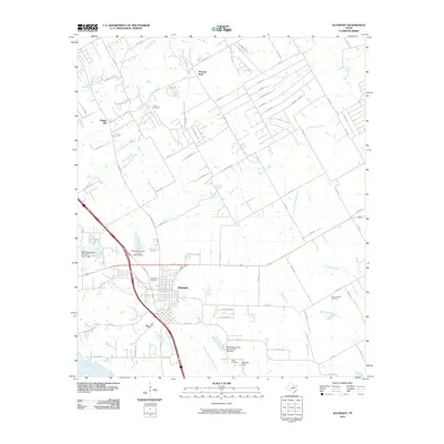
2010 Map of Alvarado
USGS Topo · Published 2010About this map
Alvarado serves as the focal point of this Johnson County survey, illustrating the town's position at the intersection of major regional transport routes. The landscape is defined by its drainages, with North Fork Chambers Creek flowing south toward Lake Alvarado while Mountain Creek and Walnut Creek carve paths through the northern half of the quadrangle. Significant for family historians, the map identifies several distinct burial grounds, including Glenwood Cemetery near the town center and the more outlying Cahill Cemetery, Center League Cemetery, and Duke Cemetery.
Find a feature on this map
75 named features on this map. Tap any name to fly to it.
Don’t see what you’re looking for? This feature index may not catch every label — zoom into the map to look around manually.
Map Details
Editions of this 2010 Alvarado Map
This is the sole edition of this map. No revisions or reprints were ever made.
Other maps of this area

1891 · Cleburne
USGS Topo · 1:125,000

1894 · Cleburne
USGS Topo · 1:125,000

1894 · Fort Worth
USGS Topo · 1:125,000

1954 · Dallas
USGS Topo · 1:250,000

1955 · Burleson
USGS Topo · 1:24,000

1958 · Dallas
USGS Topo · 1:250,000

1959 · Britton
USGS Topo · 1:24,000

1959 · Mansfield
USGS Topo · 1:24,000
1959 · Arlington
USGS Topo · 1:62,500

1960 · Keene
USGS Topo · 1:24,000