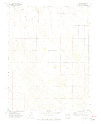
1971 Map of Alvin SW
USGS Topo · Published 1974About this map
Northeastern Colorado’s rolling sand hills and high plains are documented here in 1971, revealing a landscape defined by resource extraction and land management. The terrain is notably marked by numerous wells scattered across the township and range grids, indicating the intensive water management or mineral activity common to this portion of Yuma County. A long-distance Pipeline traverses the northern section, cutting diagonally through the topography as a piece of mid-century infrastructure. Of particular interest to local historians and genealogists is a single isolated Grave, located in the central portion of the sheet. This solitary marker in an otherwise sparsely populated area suggests an early burial or family site that predates modern cemetery consolidation, preserved amidst the repetitive swell of the dunes and sections.
Find a feature on this map
6 named features on this map. Tap any name to fly to it.
Don’t see what you’re looking for? This feature index may not catch every label — zoom into the map to look around manually.
Map Details
Editions of this 1971 Alvin SW Map
3 editions found
Other maps of this area

1954 · Sterling
USGS Topo · 1:250,000

1958 · Sterling
USGS Topo · 1:250,000

1971 · Alvin NW
USGS Topo · 1:24,000

1971 · Alvin SW
USGS Topo · 1:24,000

1971 · Wauneta NE
USGS Topo · 1:24,000

1971 · Alvin
USGS Topo · 1:24,000

1971 · Wauneta
USGS Topo · 1:24,000

1971 · Wray NE
USGS Topo · 1:24,000

1971 · Eckley NE
USGS Topo · 1:24,000

1971 · Alvin NE
USGS Topo · 1:24,000