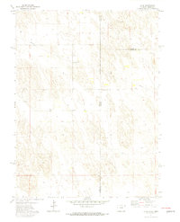
1971 Map of Alvin
USGS Topo · Published 1974About this map
Alvin sits at the center of this 1971 survey, representing a remote agricultural crossroads where the high plains of Colorado meet the Nebraska panhandle. This map documents a sparsely populated corner of Yuma County defined by its proximity to state and county lines, including the triple intersection of Yuma, Chase, and Dundy counties. The landscape is characterized by its utilitarian infrastructure, from the local Gravel Pit to the industrial Pumping Sta and a major Pipeline cutting across the northern sections. Genealogists and local historians will find the Hughes Cem located just across the Colorado Nebraska border, providing a specific reference point for early families who settled this tri-state boundary region during the mid-20th century.
Find a feature on this map
9 named features on this map. Tap any name to fly to it.
Don’t see what you’re looking for? This feature index may not catch every label — zoom into the map to look around manually.
Map Details
Editions of this 1971 Alvin Map
3 editions found
Other maps of this area

1954 · Sterling
USGS Topo · 1:250,000

1954 · McCook
USGS Topo · 1:250,000

1957 · McCook
USGS Topo · 1:250,000

1958 · McCook
USGS Topo · 1:250,000

1958 · Sterling
USGS Topo · 1:250,000

1971 · Alvin NW
USGS Topo · 1:24,000

1971 · Alvin SW
USGS Topo · 1:24,000

1971 · Alvin
USGS Topo · 1:24,000

1971 · Wray NE
USGS Topo · 1:24,000

1971 · Alvin NE
USGS Topo · 1:24,000