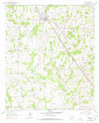
1961 Map of Alvord
USGS Topo · Published 1978About this map
The town of Alvord serves as the focal point for this Wise County landscape, situated along the Fort Worth and Denver railroad. The map depicts a region transitioning from rural agriculture to an intensive petroleum and natural gas economy, dominated by expansive areas like Alvord Field, Boonsville Oil Field, and the Alvord Southeast Bryson Oil Field. Dozens of individual oil and gas wells are scattered across the terrain, illustrating the industrial density of the mid-century Texas energy boom.
Find a feature on this map
36 named features on this map. Tap any name to fly to it.
Don’t see what you’re looking for? This feature index may not catch every label — zoom into the map to look around manually.
Map Details
Editions of this 1961 Alvord Map
3 editions found
Other maps of this area

1930 · Boyd
USGS Topo · 1:62,500

1954 · Sherman
USGS Topo · 1:250,000

1958 · Sherman
USGS Topo · 1:250,000

1960 · Bridgeport West
USGS Topo · 1:24,000

1960 · Bridgeport East
USGS Topo · 1:24,000

1960 · Decatur
USGS Topo · 1:24,000

1961 · Pecan Creek
USGS Topo · 1:24,000

1961 · Alvord
USGS Topo · 1:24,000

1961 · New Harp
USGS Topo · 1:24,000

1961 · Sunset
USGS Topo · 1:24,000