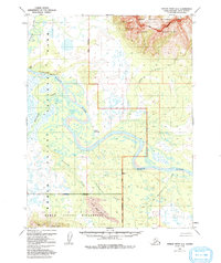
1955 Map of Ambler River A-5
USGS Topo · Published 1992About this map
The Kobuk River meanders through a landscape defined by dramatic transitions between water, mountain, and sand in this 1955 survey. This area is anchored by Onion Portage, a site of immense significance for understanding human movement and subsistence along the river corridor. To the north, the sharp relief of the Jade Mountains rises above Jade Creek, while the southern portion of the map is dominated by the unique geomorphology of the Little Kobuk Sand Dunes near the Waring Mountains. Within the boundaries of what is now Kobuk Valley National Park, the map records several isolated Cabin and Cabins sites, indicating seasonal habitation or travel waypoints. The intricate network of tributaries, including the Akillik River and Tunutuk Creek, highlights the complex hydrology of the valley before later wilderness designations formally protected the Kobuk Valley Wilderness.
Find a feature on this map
18 named features on this map. Tap any name to fly to it.
Don’t see what you’re looking for? This feature index may not catch every label — zoom into the map to look around manually.
Map Details
Editions of this 1955 Ambler River A-5 Map
3 editions found
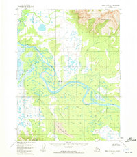
Other maps of this area

1951 · Shungnak
USGS Topo · 1:250,000

1951 · Ambler River
USGS Topo · 1:250,000

1955 · Shungnak
USGS Topo · 1:250,000

1955 · Ambler River A-4
USGS Topo · 1:63,360

1955 · Ambler River A-6
USGS Topo · 1:63,360

1955 · Shungnak D-4
USGS Topo · 1:63,360

1955 · Shungnak D-6
USGS Topo · 1:63,360

1955 · Shungnak D-5
USGS Topo · 1:63,360

1955 · Ambler River A-5
USGS Topo · 1:63,360

1956 · Ambler River
USGS Topo · 1:250,000