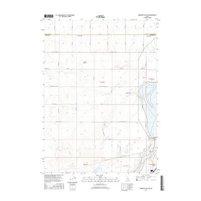
2017 Map of American Falls SW
USGS Topo · Published 2017About this map
Pleasant Valley serves as a central anchor for this agricultural landscape, where a precise grid of rural roads such as Tiede Allen Rd and Center Pleasant Valley Rd divides the Idaho plains. The map illustrates the sophisticated water management systems essential to the region's economy, featuring the Highline Canal and various irrigation laterals, including Lateral P and Lateral R. Along the eastern edge, the geography shifts dramatically at the American Falls Reservoir, where the Snake River continues its course through a series of distinct natural features. Points of interest for local historians include the spring-fed drainages of Spring Hollow and Davis Springs, alongside the curiously named Ferry Hollow. The transition from the high plateau of the Bingham Co line down to the reservoir basin highlights the specific topographical challenges faced by early settlers and modern developers in managing this high-desert environment.
Find a feature on this map
55 named features on this map. Tap any name to fly to it.
Don’t see what you’re looking for? This feature index may not catch every label — zoom into the map to look around manually.
Map Details
Editions of this 2017 American Falls SW Map
This is the sole edition of this map. No revisions or reprints were ever made.
Other maps of this area

1934 · American Falls
USGS Topo · 1:62,500

1934 · Rockland
USGS Topo · 1:62,500

1936 · American Falls
USGS Topo · 1:62,500

1937 · Rockland
USGS Topo · 1:62,500

1954 · Pocatello
USGS Topo · 1:250,000

1958 · Pocatello
USGS Topo · 1:250,000

1959 · Yale
USGS Topo · 1:62,500
1971 · Indian Springs
USGS Topo · 1:24,000
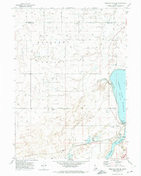
1971 · American Falls SW
USGS Topo · 1:24,000
1971 · Aberdeen
USGS Topo · 1:24,000