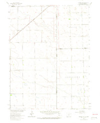
1962 Map of Amherst NE
USGS Topo · Published 1964About this map
The Chicago Burlington and Quincy railroad cuts diagonally across this high plains landscape at the border of Colorado and Nebraska. This 1962 survey documents a rural environment defined by large township divisions, including the expansive Grace and Jamestown districts. The terrain is marked by subtle drainage patterns and isolated agricultural improvements, such as various wells scattered across the range. Near the northern boundary, the Venango Cem provides a specific point of interest for genealogists tracking early families in this tri-county intersection. The map illustrates the administrative meeting point of Phillips Co and Sedgwick Co in Colorado with Perkins Co and Chase Co in Nebraska, capturing the surveyed grid of the American West.
Find a feature on this map
10 named features on this map. Tap any name to fly to it.
Don’t see what you’re looking for? This feature index may not catch every label — zoom into the map to look around manually.
Map Details
Editions of this 1962 Amherst NE Map
3 editions found

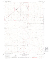
Other maps of this area

1954 · Sterling
USGS Topo · 1:250,000

1954 · McCook
USGS Topo · 1:250,000

1957 · McCook
USGS Topo · 1:250,000

1958 · McCook
USGS Topo · 1:250,000

1958 · Sterling
USGS Topo · 1:250,000

1961 · Lamar
USGS Topo · 1:24,000

1961 · Lamar NW
USGS Topo · 1:24,000

1961 · Brandon
USGS Topo · 1:24,000

1962 · Venango SW
USGS Topo · 1:24,000

1962 · Amherst
USGS Topo · 1:24,000