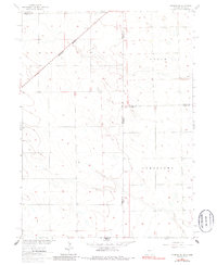
1962 Map of Amherst NE
USGS Topo · Published 1986About this map
The Burlington Northern railroad cuts diagonally across this high plains landscape at the intersection of northeastern Colorado and western Nebraska. Surveyed in the late 1950s and field-checked in 1962, the map illustrates the precise division of agricultural lands near the tri-state corner. The terrain is marked by broad geographic designations such as Grace and Jamestown, reflecting the large-scale spatial organization of the region. Local history and genealogy are anchored by the Venango Cem, located just across the state line in Nebraska. The scarcity of named landmarks highlights the area's rural character, where the primary features are section lines, elevation points, and a few isolated Wells, showcasing the infrastructure of mid-century prairie farming and the importance of rail transport for remote agricultural communities.
Find a feature on this map
10 named features on this map. Tap any name to fly to it.
Don’t see what you’re looking for? This feature index may not catch every label — zoom into the map to look around manually.
Map Details
Editions of this 1962 Amherst NE Map
3 editions found

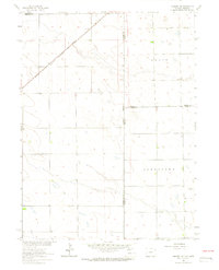
Other maps of this area

1954 · Sterling
USGS Topo · 1:250,000

1954 · McCook
USGS Topo · 1:250,000

1957 · McCook
USGS Topo · 1:250,000

1958 · McCook
USGS Topo · 1:250,000

1958 · Sterling
USGS Topo · 1:250,000

1961 · Lamar
USGS Topo · 1:24,000

1961 · Lamar NW
USGS Topo · 1:24,000

1961 · Brandon
USGS Topo · 1:24,000

1962 · Venango SW
USGS Topo · 1:24,000

1962 · Amherst
USGS Topo · 1:24,000