
1962 Map of Amherst NE
USGS Topo · Published 1964About this map
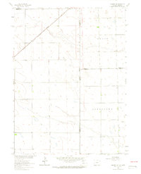
The Colorado Nebraska state line bisects this high plains landscape during the early 1960s, marking a complex intersection of county boundaries including Phillips Co, Sedgwick Co, Perkins Co, and Chase Co. The map records a sparse, agricultural environment characterized by the large townships of Grace and Jamestown. A critical infrastructure link for the region is the Chicago Burlington and Quincy railroad, which cuts diagonally across the northern corner of the sheet. For local historians and genealogists, the Venango Cem serves as a primary landmark in the northeastern portion of the map, situated near the transition from Colorado into Nebraska. The presence of numerous wells indicates the vital importance of groundwater for the remote homesteads and farms scattered across this prairie terrain.
Find a feature on this map
10 named features on this map. Tap any name to fly to it.
Don’t see what you’re looking for? This feature index may not catch every label — zoom into the map to look around manually.
Map Details
Editions of this 1962 Amherst NE Map
3 editions found
Other maps of this area

1954 · Sterling
USGS Topo · 1:250,000

1954 · McCook
USGS Topo · 1:250,000

1957 · McCook
USGS Topo · 1:250,000

1958 · McCook
USGS Topo · 1:250,000

1958 · Sterling
USGS Topo · 1:250,000

1961 · Lamar
USGS Topo · 1:24,000

1961 · Lamar NW
USGS Topo · 1:24,000

1961 · Brandon
USGS Topo · 1:24,000

1962 · Venango SW
USGS Topo · 1:24,000

1962 · Amherst
USGS Topo · 1:24,000