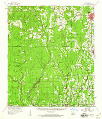
1959 Map of Amite
USGS Topo · Published 1960About this map
The Tickfaw River and Natalbany River systems define the geography of this part of southeastern Louisiana, where small farming communities and timber towns grew alongside the Illinois Central RR. In the late 1950s, the parish boundaries of St. Helena, Livingston, and Tangipahoa intersect in a landscape dotted with country churches like Mt Calvary Chapel and Macedonia Ch. This era shows a transition in local infrastructure, with numerous small burial grounds such as Leonard Chapel Cems and Hutchinson Cem serving family lineages, while the larger settlements of Amite and Independence serve as regional hubs. The presence of multiple gravel and sand pits near Baptist and Albany suggests the importance of extractive industries to the local economy alongside established rail transport.
Find a feature on this map
137 named features on this map. Tap any name to fly to it.
Don’t see what you’re looking for? This feature index may not catch every label — zoom into the map to look around manually.
Map Details
Editions of this 1959 Amite Map
3 editions found
Other maps of this area

1934 · Denham Springs
USGS Topo · 1:62,500

1934 · Springfield
USGS Topo · 1:62,500

1935 · Ponchatoula
USGS Topo · 1:62,500

1939 · Ponchatoula
USGS Topo · 1:62,500

1939 · Springfield
USGS Topo · 1:62,500

1939 · Denham Springs
USGS Topo · 1:62,500

1940 · Tickfaw
USGS Topo · 1:31,680

1940 · Roseland
USGS Topo · 1:31,680

1941 · Gilead
USGS Topo · 1:31,680

1942 · Roseland
USGS Topo · 1:31,680