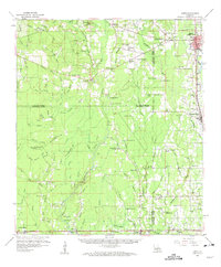
1959 Map of Amite
USGS Topo · Published 1963About this map
The Illinois Central corridor forms the backbone of this south Louisiana landscape, connecting timber and agricultural outposts like Amite City, Independence, and Holden. The terrain is defined by a dense network of waterways including the Tickfaw River and Natalbany River, which historically dictated the placement of small rural communities. The map is particularly rich in genealogical data, preserving the locations of numerous family-named landmarks and local institutions such as Morgan Chapel, Baygall Ch, and the Leonard Chapel Cemeteries. Educational centers like the Fifth Ward School and Fourth Ward School highlight the organized rural life of the era. To the south, specialized industries appear near Baptist and Albany, where several Gravel Pits and Sand Pits are noted alongside the rail lines.
Find a feature on this map
129 named features on this map. Tap any name to fly to it.
Don’t see what you’re looking for? This feature index may not catch every label — zoom into the map to look around manually.
Map Details
Editions of this 1959 Amite Map
3 editions found
Other maps of this area

1934 · Denham Springs
USGS Topo · 1:62,500

1934 · Springfield
USGS Topo · 1:62,500

1935 · Ponchatoula
USGS Topo · 1:62,500

1939 · Ponchatoula
USGS Topo · 1:62,500

1939 · Springfield
USGS Topo · 1:62,500

1939 · Denham Springs
USGS Topo · 1:62,500

1940 · Tickfaw
USGS Topo · 1:31,680

1940 · Roseland
USGS Topo · 1:31,680

1941 · Gilead
USGS Topo · 1:31,680

1942 · Roseland
USGS Topo · 1:31,680