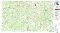
1983 Map of Amite
USGS Topo · Published 1983About this map
The Illinois Central Gulf corridor serves as the primary spine for this region of southeastern Louisiana and southwestern Mississippi, anchoring a chain of timber and agricultural towns from Kentwood and Tangipahoa down to Hammond. This 1983 edition illustrates the concentrated development along the rail line and Highway 51, contrasting with the dense network of river systems like the Amite River and Tangipahoa River that drain the piney woods. A notable historical site is the Camp Moore Confederate Cem located near Tangipahoa, a significant landmark for local history and genealogy.
Find a feature on this map
115 named features on this map. Tap any name to fly to it.
Don’t see what you’re looking for? This feature index may not catch every label — zoom into the map to look around manually.
Map Details
Editions of this 1983 Amite Map
This is the sole edition of this map. No revisions or reprints were ever made.
Other maps of this area

1906 · Bayou Sara
USGS Topo · 1:125,000

1908 · Baton Rouge
USGS Topo · 1:62,500

1934 · Denham Springs
USGS Topo · 1:62,500

1934 · Springfield
USGS Topo · 1:62,500

1935 · Slidell
USGS Topo · 1:62,500

1935 · Covington
USGS Topo · 1:62,500

1935 · Ponchatoula
USGS Topo · 1:62,500

1939 · Ponchatoula
USGS Topo · 1:62,500

1939 · Slidell
USGS Topo · 1:62,500

1939 · Zona
USGS Topo · 1:31,680