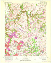
1965 Map of Anchorage
USGS Topo · Published 1972About this map
The suburban development of eastern Jefferson County is captured in mid-century detail, revealing a landscape of established estates and emerging residential enclaves. Substantial institutional landholdings occupy large tracts, most notably the Central State Hospital and the nearby Ormsby Village State Reservation. Educational and religious landmarks are prominent throughout the quadrangle, including the Kentucky Military Institute and the St Thomas Seminary, alongside numerous local schools like Ballard Memorial High Sch and the Kentucky Southern Campus University of Louisville.
Find a feature on this map
87 named features on this map. Tap any name to fly to it.
Don’t see what you’re looking for? This feature index may not catch every label — zoom into the map to look around manually.
Map Details
Editions of this 1965 Anchorage Map
2 editions found
Other maps of this area

1905 · Prospect
USGS Topo · 1:62,500

1907 · Louisville
USGS Topo · 1:62,500

1912 · Prospect
USGS Topo · 1:62,500

1929 · Taylorsville
USGS Topo · 1:62,500

1932 · La Grange
USGS Topo · 1:62,500

1937 · Jeffersonville
USGS Topo · 1:24,000

1937 · Charlestown
USGS Topo · 1:24,000

1938 · Owen
USGS Topo · 1:24,000

1946 · Jeffersonville
USGS Topo · 1:24,000

1948 · Owen
USGS Topo · 1:24,000